 KATONG WW
Current Status
Where is the vessel?
KATONG WW is currently in 294 nm N of Aquiraz, based on AIS data received about 14h ago.
Latest AIS update:
Current position: 1.00833° N, 28.33500° W (294 nm N of Aquiraz)
Average speed (last 7 days): Loading…
Average speed (last 30 days): Loading…
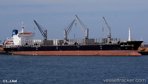
Vessel profile: KATONG WW is a General Cargo with dimensions m x m.
This page combines live AIS, route history, probable destination signals, nearby traffic, and port activity for practical vessel monitoring.
The current position of vessel KATONG WW is 1.00833 lat / -28.33500 lng. Updated: 2026-07-14 03:43:50 UTCNearest reference points:
- Open sea, approx. 475 nm off the nearest listed port
- Open sea, approx. 474 nm off the nearest listed port
- Open sea, approx. 470 nm off the nearest listed port
Currently sailing under the flag of Panama ![]()
Details:
Live Vessel KATONG WW Analytics (details, animations, etc.)
Recent AIS points (UTC):
2026-07-13 23:18:22 UTC · 1.80833, -27.95667 · SOG 11 kn · COG -1°2026-07-14 02:07:18 UTC · 1.30667, -28.19667 · SOG 11 kn · COG -1°
2026-07-14 02:07:18 UTC · 1.30667, -28.19667 · SOG 11 kn · COG -1°
2026-07-14 03:43:50 UTC · 1.00833, -28.33500 · SOG 12 kn · COG -1°