 vesseltracker.com
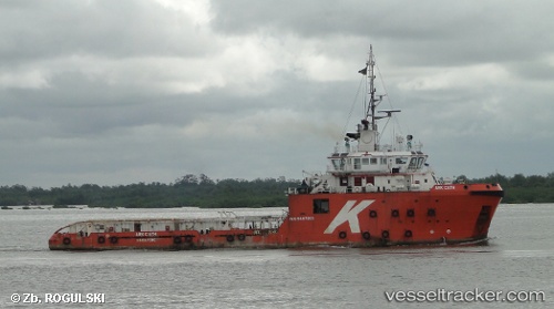
Tan Cang 89
Current StatusWhere is the vessel?
Tan Cang 89 is currently in Near Cai Mep, based on AIS data received about 3h ago.
Latest AIS update:
Current position: 10.54955° N, 107.01837° E (Near Cai Mep)
Average speed (last 7 days): Loading…
Average speed (last 30 days): Loading…
Vessel profile: Tan Cang 89 is a Offshore Tug Supply Ship with dimensions 16m x 67m.
This page combines live AIS, route history, probable destination signals, nearby traffic, and port activity for practical vessel monitoring.
The current position of vessel Tan Cang 89 is 10.54955 lat / 107.01837 lng. Updated: 2026-03-25 17:24:38 UTCNearest reference points:
- Near Cai Mep International Terminal
- Near Saigon ITV/Phu My
- Near Cai Mep
Details:
Live Vessel Tan Cang 89 Analytics (details, animations, etc.)
Recent AIS points (UTC):
2026-03-25 12:18:52 UTC · 10.54957, 107.01837 · SOG 0 kn · COG -1°2026-03-25 14:01:25 UTC · 10.54954, 107.01831 · SOG 0 kn · COG -1°
2026-03-25 15:40:03 UTC · 10.54954, 107.01832 · SOG 0 kn · COG -1°
2026-03-25 17:24:38 UTC · 10.54955, 107.01837 · SOG 0 kn · COG -1°