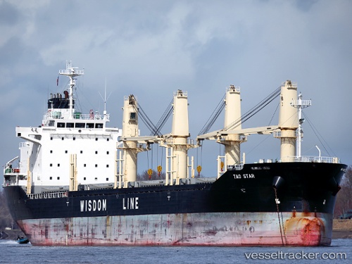
 Tao Star
Current Status
Where is the vessel?
Tao Star is currently in 11 nm SE of HELGOLAND, based on AIS data received about 14h ago.
Latest AIS update:
Current position: 54.05064° N, 8.11998° E (11 nm SE of HELGOLAND)
Average speed (last 7 days): Loading…
Average speed (last 30 days): Loading…
Vessel profile: Tao Star is a Bulk Carrier with dimensions 158m x 158m.
This page combines live AIS, route history, probable destination signals, nearby traffic, and port activity for practical vessel monitoring.
The current position of vessel Tao Star is 54.05064 lat / 8.11998 lng. Updated: 2026-05-21 04:28:07 UTCNearest reference points:
- 10 nm E of Wangerooge
- Near Wangerooge
- Near HOOKSIEL
Currently sailing under the flag of Panama ![]()
Tao Star built in 2010 year
Deadweight:
25064 tDetails:
Live Vessel Tao Star Analytics (details, animations, etc.)
Recent AIS points (UTC):
2026-05-21 01:26:02 UTC · 54.04986, 8.12189 · SOG 0 kn · COG 259°2026-05-21 01:46:02 UTC · 54.05002, 8.12182 · SOG 0 kn · COG 254°
2026-05-21 04:01:08 UTC · 54.05072, 8.12069 · SOG 0.1 kn · COG 203°
2026-05-21 04:28:07 UTC · 54.05064, 8.11998 · SOG 0.1 kn · COG 182°