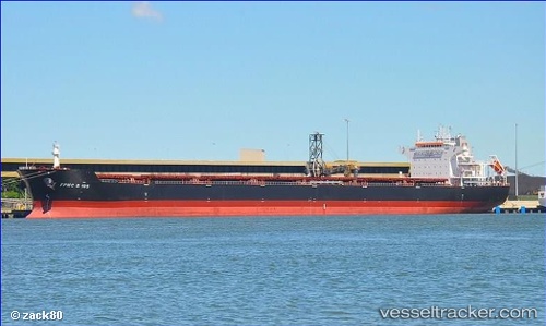
 Fpmc B 105
Current Status
Where is the vessel?
Fpmc B 105 is currently in Near Vung Áng, based on AIS data received about 15h ago.
Latest AIS update:
Current position: 18.05167° N, 106.44167° E (Near Vung Áng)
Average speed (last 7 days): Loading…
Average speed (last 30 days): Loading…
Vessel profile: Fpmc B 105 is a Bulk Carrier with dimensions 229m x 229m.
This page combines live AIS, route history, probable destination signals, nearby traffic, and port activity for practical vessel monitoring.
The current position of vessel Fpmc B 105 is 18.05167 lat / 106.44167 lng. Updated: 2026-07-13 22:25:48 UTCNearest reference points:
- 60 nm NE of Son Duong Port
- 61 nm E of Hon La Port
- 48 nm NE of Cua Viet Port
Currently sailing under the flag of Liberia ![]()
Fpmc B 105 built in 2011 year
Deadweight:
93295 tDetails:
Live Vessel Fpmc B 105 Analytics (details, animations, etc.)
Recent AIS points (UTC):
2026-07-13 19:07:01 UTC · 18.05216, 106.44324 · SOG 0 kn · COG 243°2026-07-13 19:36:57 UTC · 18.05187, 106.44321 · SOG 0 kn · COG 243°
2026-07-13 21:28:01 UTC · 18.05194, 106.44315 · SOG 0 kn · COG 243°
2026-07-13 22:25:48 UTC · 18.05167, 106.44167 · SOG 0 kn · COG -1°