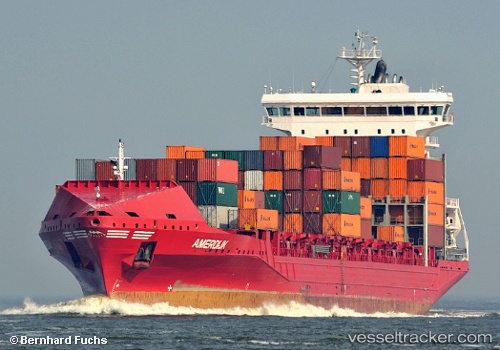
 SOUTH
SOUTH
Current Status
Where is the vessel?
SOUTH is currently in Near Bremerhaven-Speckenbüttel, based on AIS data received about 14h ago.
Latest AIS update:
Current position: 53.58592° N, 8.52808° E (Near Bremerhaven-Speckenbüttel)
Average speed (last 7 days): Loading…
Average speed (last 30 days): Loading…
Vessel profile: SOUTH is a Container Ship with dimensions m x m.
This page combines live AIS, route history, probable destination signals, nearby traffic, and port activity for practical vessel monitoring.
The current position of vessel SOUTH is 53.58592 lat / 8.52808 lng. Updated: 2026-05-22 20:00:54 UTCNearest reference points:
- Near Bremerhaven
- Near Sandstedt
- Near Brake
Currently sailing under the flag of Malta ![]()
Details:
Live Vessel SOUTH Analytics (details, animations, etc.)
Recent AIS points (UTC):
2026-05-22 16:40:00 UTC · 53.86867, 7.88968 · SOG 12.2 kn · COG 123°2026-05-22 17:27:45 UTC · 53.78360, 8.15362 · SOG 13.7 kn · COG 148°
2026-05-22 19:22:34 UTC · 53.58590, 8.52803 · SOG 0.3 kn · COG 150°
2026-05-22 20:00:54 UTC · 53.58592, 8.52808 · SOG 0 kn · COG 152°