 vesseltracker.com
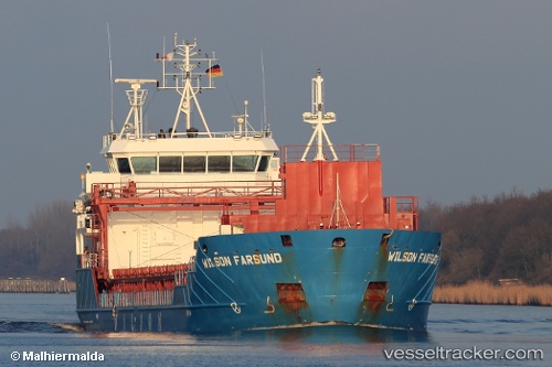
 Wilson Farsund
Current Status
Where is the vessel?
Wilson Farsund is currently in 27 nm SE of Lillesand, based on AIS data received about 1h ago.
Latest AIS update:
Current position: 57.85500° N, 8.82693° E (27 nm SE of Lillesand)
Average speed (last 7 days): Loading…
Average speed (last 30 days): Loading…
Vessel profile: Wilson Farsund is a Multi Purpose Carrier with dimensions 90m x 90m.
This page combines live AIS, route history, probable destination signals, nearby traffic, and port activity for practical vessel monitoring.
The current position of vessel Wilson Farsund is 57.85500 lat / 8.82693 lng. Updated: 2026-05-13 02:16:16 UTCNearest reference points:
- 28 nm NW of Lokken
- 27 nm N of HANSTHOLM
- Near HANSTHOLM
Currently sailing under the flag of Barbados ![]()
Wilson Farsund built in 2012 year
Deadweight:
4340 tDetails:
Live Vessel Wilson Farsund Analytics (details, animations, etc.)
Recent AIS points (UTC):
2026-05-12 22:27:34 UTC · 57.89331, 7.80778 · SOG 8.3 kn · COG 94°2026-05-12 23:29:54 UTC · 57.88588, 8.07949 · SOG 8.4 kn · COG 94°
2026-05-13 01:21:53 UTC · 57.86356, 8.58308 · SOG 8.5 kn · COG 98°
2026-05-13 02:16:16 UTC · 57.85500, 8.82693 · SOG 8.6 kn · COG 93°