 vesseltracker.com
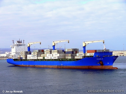
 Gulbeniz A
Current Status
Where is the vessel?
Gulbeniz A is currently in Near YALOVA, based on AIS data received about 7d ago.
Latest AIS update:
Current position: 40.72432° N, 29.48290° E (Near YALOVA)
Average speed (last 7 days): Loading…
Average speed (last 30 days): Loading…
Vessel profile: Gulbeniz A is a Container Ship with dimensions 210m x 30m.
This page combines live AIS, route history, probable destination signals, nearby traffic, and port activity for practical vessel monitoring.
The current position of vessel Gulbeniz A is 40.72432 lat / 29.48290 lng. Updated: 2026-05-07 18:39:00 UTCNearest reference points:
- Near YALOVA
- Near Yilport
- Near Diliskelesi
Currently sailing under the flag of Turkey ![]()
Gulbeniz A built in 2011 year
Deadweight:
34943 tDetails:
Live Vessel Gulbeniz A Analytics (details, animations, etc.)
Recent AIS points (UTC):
2026-05-07 18:39:00 UTC · 40.72432, 29.48290 · SOG 0 kn · COG 331°2026-05-07 18:39:00 UTC · 40.72432, 29.48290 · SOG 0 kn · COG 331°
2026-05-07 18:39:00 UTC · 40.72432, 29.48290 · SOG 0 kn · COG 331°
2026-05-07 18:39:00 UTC · 40.72432, 29.48290 · SOG 0 kn · COG 331°