 vesseltracker.com
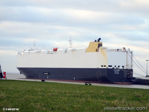
 Patara
Current Status
Where is the vessel?
Patara is currently in 40 nm W of Petrolia, based on AIS data received about 1h ago.
Latest AIS update:
Current position: 40.17650° N, 125.13700° W (40 nm W of Petrolia)
Average speed (last 7 days): Loading…
Average speed (last 30 days): Loading…
Vessel profile: Patara is a Vehicles Carrier with dimensions 183m x 32m.
This page combines live AIS, route history, probable destination signals, nearby traffic, and port activity for practical vessel monitoring.
The current position of vessel Patara is 40.1765 lat / -125.137 lng. Updated: 2026-04-27 17:30:55 UTCNearest reference points:
- Near Little River
- Near Bodega Bay
Currently sailing under the flag of Germany ![]()
Patara built in 2012 year
Deadweight:
12755 tDetails:
Live Vessel Patara Analytics (details, animations, etc.)
Recent AIS points (UTC):
2026-04-27 13:35:53 UTC · 39.20910, -124.74200 · SOG 15.9 kn · COG 341°2026-04-27 15:56:26 UTC · 39.78930, -124.97800 · SOG 15 kn · COG 343°
2026-04-27 16:51:29 UTC · 40.01360, -125.07200 · SOG 16 kn · COG 346°
2026-04-27 17:30:55 UTC · 40.17650, -125.13700 · SOG 15.3 kn · COG 344°