 vesseltracker.com
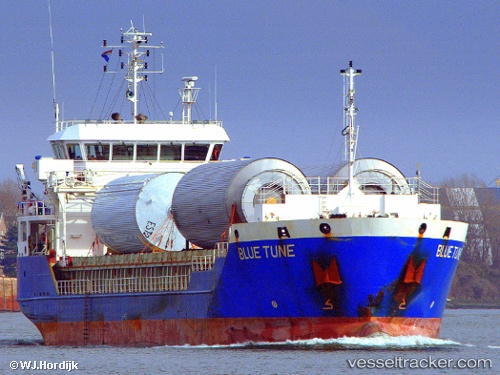
 Blue Tune
Current Status
Where is the vessel?
Blue Tune is currently in Near Casablanca, based on AIS data received about 1h ago.
Latest AIS update:
Current position: 33.60975° N, 7.60487° W (Near Casablanca)
Average speed (last 7 days): Loading…
Average speed (last 30 days): Loading…
Vessel profile: Blue Tune is a General Cargo Ship with dimensions 90m x 16m.
This page combines live AIS, route history, probable destination signals, nearby traffic, and port activity for practical vessel monitoring.
The current position of vessel Blue Tune is 33.60975 lat / -7.60487 lng. Updated: 2026-05-14 07:21:15 UTCNearest reference points:
- Near Mohammedia
- Near Jorf Lasfar
- 54 nm N of El Jadida
Currently sailing under the flag of Antigua Barbuda ![]()
Blue Tune built in 2010 year
Deadweight:
5193 tDetails:
Live Vessel Blue Tune Analytics (details, animations, etc.)
Recent AIS points (UTC):
2026-05-14 04:12:34 UTC · 33.63288, -7.58915 · SOG 0.1 kn · COG 46°2026-05-14 06:18:33 UTC · 33.63299, -7.58899 · SOG 0.4 kn · COG 52°
2026-05-14 07:03:32 UTC · 33.60983, -7.60507 · SOG 1.2 kn · COG 152°
2026-05-14 07:21:15 UTC · 33.60975, -7.60487 · SOG 0.1 kn · COG 152°