 The Sheriff
Current Status
Where is the vessel?
The Sheriff is currently in Near Hunsdon, based on AIS data received about 14h ago.
Latest AIS update:
Current position: 51.87644° N, 3.47377° E (Near Hunsdon)
Average speed (last 7 days): Loading…
Average speed (last 30 days): Loading…
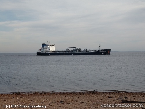
Vessel profile: The Sheriff is a Bitumen Tanker with dimensions 134m x 24m.
This page combines live AIS, route history, probable destination signals, nearby traffic, and port activity for practical vessel monitoring.
The current position of vessel The Sheriff is 51.87644 lat / 3.47377 lng. Updated: 2026-05-22 10:04:09 UTCNearest reference points:
- 12 nm NE of Hunsdon
- Near Hunsdon
- Near NEELTJE JANS
Currently sailing under the flag of Marshall Is ![]()
The Sheriff built in 2013 year
Deadweight:
14911 tDetails:
Live Vessel The Sheriff Analytics (details, animations, etc.)
Recent AIS points (UTC):
2026-05-22 07:07:01 UTC · 51.87723, 3.47613 · SOG 0 kn · COG 196°2026-05-22 08:16:00 UTC · 51.87725, 3.47566 · SOG 0 kn · COG 182°
2026-05-22 09:22:00 UTC · 51.87688, 3.47417 · SOG 0 kn · COG 130°
2026-05-22 10:04:09 UTC · 51.87644, 3.47377 · SOG 0 kn · COG 107°