 Dublin Sea
Current Status
Where is the vessel?
Dublin Sea is currently in 14 nm W of Tatoosh Island, based on AIS data received about 14h ago.
Latest AIS update:
Current position: 48.37208° N, 125.09136° W (14 nm W of Tatoosh Island)
Average speed (last 7 days): Loading…
Average speed (last 30 days): Loading…
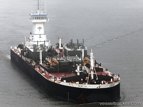
Vessel profile: Dublin Sea is a Pusher Tug with dimensions 204m x 24m.
This page combines live AIS, route history, probable destination signals, nearby traffic, and port activity for practical vessel monitoring.
The current position of vessel Dublin Sea is 48.37208 lat / -125.09136 lng. Updated: 2026-05-21 21:49:58 UTCNearest reference points:
- 21 nm NW of Tatoosh Island
- Near Clallam Bay
- Near Nanaimo
Currently sailing under the flag of USA ![]()
Dublin Sea built in 2009 year
Deadweight:
448 tDetails:
Live Vessel Dublin Sea Analytics (details, animations, etc.)
Recent AIS points (UTC):
2026-05-21 17:30:58 UTC · 47.70333, -125.66333 · SOG 10 kn · COG -1°2026-05-21 19:08:47 UTC · 47.95877, -125.50198 · SOG 9.9 kn · COG 21°
2026-05-21 20:10:06 UTC · 48.11420, -125.35322 · SOG 11.6 kn · COG 38°
2026-05-21 21:49:58 UTC · 48.37208, -125.09136 · SOG 11 kn · COG 31°