 WAN HAI 271
Current Status
Where is the vessel?
WAN HAI 271 is currently in 61 nm SW of Kâmpóng Saôm, based on AIS data received about 14h ago.
Latest AIS update:
Current position: 9.88148° N, 102.79491° E (61 nm SW of Kâmpóng Saôm)
Average speed (last 7 days): Loading…
Average speed (last 30 days): Loading…
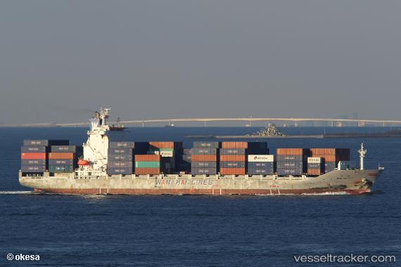
Vessel profile: WAN HAI 271 is a Container Ship with dimensions m x m.
This page combines live AIS, route history, probable destination signals, nearby traffic, and port activity for practical vessel monitoring.
The current position of vessel WAN HAI 271 is 9.88148 lat / 102.79491 lng. Updated: 2026-05-19 18:12:49 UTCNearest reference points:
- 63 nm NW of Dai Hung (STS Load)
- 46 nm W of Dai Hung (STS Load)
- Near KRONG PREAH SIHANOUK
Currently sailing under the flag of Taiwan ![]()
Details:
Live Vessel WAN HAI 271 Analytics (details, animations, etc.)
Recent AIS points (UTC):
2026-05-19 14:04:02 UTC · 10.75882, 102.13581 · SOG 15.8 kn · COG 144°2026-05-19 15:26:20 UTC · 10.46878, 102.35583 · SOG 15.9 kn · COG 142°
2026-05-19 16:54:50 UTC · 10.15894, 102.59385 · SOG 15.6 kn · COG 143°
2026-05-19 18:12:49 UTC · 9.88148, 102.79491 · SOG 15.9 kn · COG 143°