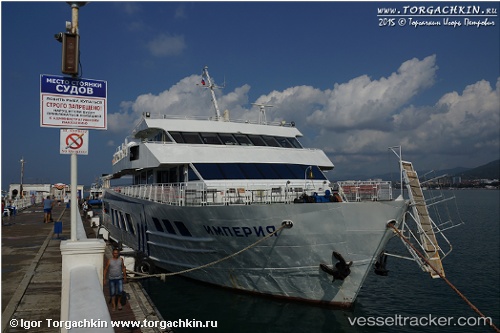
Imperia
Current StatusWhere is the vessel?
Imperia is currently in Near GELENDZHIK, based on AIS data received about 14h ago.
Latest AIS update:
Current position: 44.63457° N, 38.00583° E (Near GELENDZHIK)
Average speed (last 7 days): Loading…
Average speed (last 30 days): Loading…
Vessel profile: Imperia is a Cruise Ship with dimensions 14m x 45m.
This page combines live AIS, route history, probable destination signals, nearby traffic, and port activity for practical vessel monitoring.
The current position of vessel Imperia is 44.63457 lat / 38.00583 lng. Updated: 2026-05-21 04:04:35 UTCNearest reference points:
- Near GELENDZHIK
- Near Novorossiysk
- 11 nm SE of GELENDZHIK
Details:
Live Vessel Imperia Analytics (details, animations, etc.)
Recent AIS points (UTC):
2026-05-21 04:04:35 UTC · 44.63457, 38.00583 · SOG 7.9 kn · COG 269°2026-05-21 04:04:35 UTC · 44.63457, 38.00583 · SOG 7.9 kn · COG 269°
2026-05-21 04:04:35 UTC · 44.63457, 38.00583 · SOG 7.9 kn · COG 269°
2026-05-21 04:04:35 UTC · 44.63457, 38.00583 · SOG 7.9 kn · COG 269°