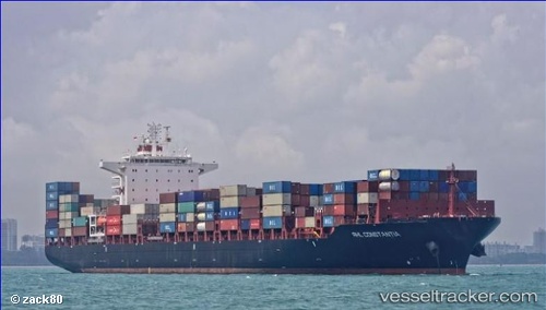
Rhl Constantia
Current StatusWhere is the vessel?
Rhl Constantia is currently in Near Saint-John Apt, based on AIS data received about 15h ago.
Latest AIS update:
Current position: 45.21863° N, 66.03498° W (Near Saint-John Apt)
Average speed (last 7 days): Loading…
Average speed (last 30 days): Loading…
Vessel profile: Rhl Constantia is a Container Ship with dimensions 38m x 260m.
This page combines live AIS, route history, probable destination signals, nearby traffic, and port activity for practical vessel monitoring.
The current position of vessel Rhl Constantia is 45.21863 lat / -66.03498 lng. Updated: 2026-06-13 14:12:55 UTCNearest reference points:
- Near St. John
- Near Tiverton
- 16 nm W of Tiverton
Details:
Live Vessel Rhl Constantia Analytics (details, animations, etc.)
Recent AIS points (UTC):
2026-06-13 11:11:52 UTC · 44.66436, -66.20429 · SOG 13.4 kn · COG 10°2026-06-13 12:07:11 UTC · 44.85681, -66.12437 · SOG 12.3 kn · COG 10°
2026-06-13 13:40:52 UTC · 45.14053, -66.07100 · SOG 8.9 kn · COG 16°
2026-06-13 14:12:55 UTC · 45.21863, -66.03498 · SOG 10.7 kn · COG 351°