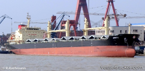
Amity
Current StatusWhere is the vessel?
Amity is currently in Near BIZERTE, based on AIS data received about 14h ago.
Latest AIS update:
Current position: 37.27167° N, 9.98500° E (Near BIZERTE)
Average speed (last 7 days): Loading…
Average speed (last 30 days): Loading…
Vessel profile: Amity is a Bulk Carrier with dimensions 26m x 177m.
This page combines live AIS, route history, probable destination signals, nearby traffic, and port activity for practical vessel monitoring.
The current position of vessel Amity is 37.27167 lat / 9.98500 lng. Updated: 2026-05-20 23:20:23 UTCNearest reference points:
- Near Le Kram
- 33 nm SE of Setubal
- 32 nm N of Qulaybiyah
Details:
Live Vessel Amity Analytics (details, animations, etc.)
Recent AIS points (UTC):
2026-05-20 17:58:46 UTC · 37.27042, 9.98493 · SOG 0 kn · COG 329°2026-05-20 21:47:20 UTC · 37.27167, 9.98500 · SOG 0 kn · COG -1°
2026-05-20 23:02:23 UTC · 37.27167, 9.98500 · SOG 0 kn · COG -1°
2026-05-20 23:20:23 UTC · 37.27167, 9.98500 · SOG 0 kn · COG -1°