 Rei Maru
Current Status
Where is the vessel?
Rei Maru is currently in 30 nm SE of Saga, based on AIS data received about 16h ago.
Latest AIS update:
Current position: 32.82463° N, 133.60300° E (30 nm SE of Saga)
Average speed (last 7 days): Loading…
Average speed (last 30 days): Loading…
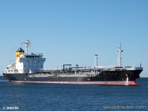
Vessel profile: Rei Maru is a Oil Products Tanker with dimensions 104m x 104m.
This page combines live AIS, route history, probable destination signals, nearby traffic, and port activity for practical vessel monitoring.
The current position of vessel Rei Maru is 32.82463 lat / 133.60300 lng. Updated: 2026-07-15 07:21:55 UTCNearest reference points:
- Near Kochi
- 77 nm S of Sukumowan
- Near NYUGAWA
Currently sailing under the flag of Japan ![]()
Rei Maru built in 2009 year
Deadweight:
5916 tDetails:
Live Vessel Rei Maru Analytics (details, animations, etc.)
Recent AIS points (UTC):
2026-07-15 02:14:29 UTC · 33.00340, 132.25574 · SOG 16.4 kn · COG -1°2026-07-15 04:08:31 UTC · 32.66402, 132.63092 · SOG 15.8 kn · COG 92°
2026-07-15 07:21:55 UTC · 32.82463, 133.60300 · SOG 16.3 kn · COG -1°
2026-07-15 07:21:55 UTC · 32.82463, 133.60300 · SOG 16.3 kn · COG -1°