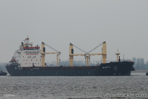
 Belasitza
Current Status
Where is the vessel?
Belasitza is currently in 51 nm N of Sainte-Marie, based on AIS data received about 15h ago.
Latest AIS update:
Current position: 20.04031° S, 55.67338° E (51 nm N of Sainte-Marie)
Average speed (last 7 days): Loading…
Average speed (last 30 days): Loading…
Vessel profile: Belasitza is a Bulk Carrier with dimensions 186m x 24m.
This page combines live AIS, route history, probable destination signals, nearby traffic, and port activity for practical vessel monitoring.
The current position of vessel Belasitza is -20.04031 lat / 55.67338 lng. Updated: 2026-08-02 04:47:40 UTCNearest reference points:
- Near Port Louis
- 164 nm NW of Pointe aux Canonniers
Currently sailing under the flag of Malta ![]()
Belasitza built in 2011 year
Deadweight:
30696 tDetails:
Live Vessel Belasitza Analytics (details, animations, etc.)
Recent AIS points (UTC):
2026-08-02 01:14:20 UTC · -20.41066, 55.09632 · SOG 10.9 kn · COG 60°2026-08-02 02:29:11 UTC · -20.28113, 55.30208 · SOG 11.1 kn · COG 55°
2026-08-02 03:33:22 UTC · -20.16510, 55.47221 · SOG 10.7 kn · COG 60°
2026-08-02 04:47:40 UTC · -20.04031, 55.67338 · SOG 10.7 kn · COG 60°