 vesseltracker.com
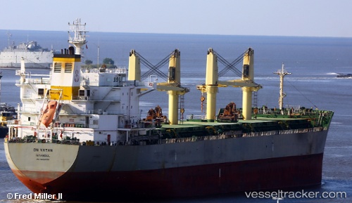
 Aliki Force
Current Status
Where is the vessel?
Aliki Force is currently in 23 nm N of ALDERNEY, based on AIS data received about 1h ago.
Latest AIS update:
Current position: 50.10343° N, 2.30820° W (23 nm N of ALDERNEY)
Average speed (last 7 days): Loading…
Average speed (last 30 days): Loading…
Vessel profile: Aliki Force is a Bulk Carrier with dimensions 196m x 32m.
This page combines live AIS, route history, probable destination signals, nearby traffic, and port activity for practical vessel monitoring.
The current position of vessel Aliki Force is 50.10343 lat / -2.30820 lng. Updated: 2026-05-14 14:05:36 UTCNearest reference points:
- Near ALDERNEY
- Near Castletown
- Near WEYMOUTH
Currently sailing under the flag of Marshall Is ![]()
Aliki Force built in 2011 year
Deadweight:
58419 tDetails:
Live Vessel Aliki Force Analytics (details, animations, etc.)
Recent AIS points (UTC):
2026-05-14 10:38:46 UTC · 50.26638, -1.42577 · SOG 11.9 kn · COG 255°2026-05-14 11:34:27 UTC · 50.22212, -1.69857 · SOG 10.9 kn · COG 250°
2026-05-14 13:41:16 UTC · 50.11907, -2.22060 · SOG 8.8 kn · COG 256°
2026-05-14 14:05:36 UTC · 50.10343, -2.30820 · SOG 8.4 kn · COG 252°