 XIN E
XIN E
Current Status
Where is the vessel?
XIN E is currently in 15 nm SW of Craven Arms, based on AIS data received about 15h ago.
Latest AIS update:
Current position: 52.21292° N, 2.65900° E (15 nm SW of Craven Arms)
Average speed (last 7 days): Loading…
Average speed (last 30 days): Loading…
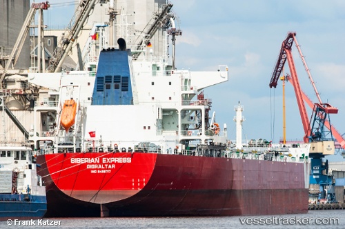
Vessel profile: XIN E is a Bulk Carrier with dimensions 229m x 38m.
This page combines live AIS, route history, probable destination signals, nearby traffic, and port activity for practical vessel monitoring.
The current position of vessel XIN E is 52.21292 lat / 2.65900 lng. Updated: 2026-05-20 17:37:36 UTCNearest reference points:
- 21 nm S of Craven Arms
- Near Craven Arms
- Near Hunsdon
Currently sailing under the flag of Liberia ![]()
XIN E built in 2012 year
Deadweight:
92974 tDetails:
Live Vessel XIN E Analytics (details, animations, etc.)
Recent AIS points (UTC):
2026-05-20 13:52:08 UTC · 52.67995, 3.05535 · SOG 10.1 kn · COG 207°2026-05-20 15:40:50 UTC · 52.43167, 2.83666 · SOG 8 kn · COG -1°
2026-05-20 16:25:38 UTC · 52.34345, 2.76620 · SOG 7.6 kn · COG 205°
2026-05-20 17:37:36 UTC · 52.21292, 2.65900 · SOG 6.9 kn · COG 202°