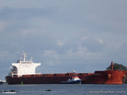
 MASTRO MICHAEL
Current Status
Where is the vessel?
MASTRO MICHAEL is currently in Near Erdemir, based on AIS data received about 15h ago.
Latest AIS update:
Current position: 41.26689° N, 31.38491° E (Near Erdemir)
Average speed (last 7 days): Loading…
Average speed (last 30 days): Loading…
Vessel profile: MASTRO MICHAEL is a Bulk Carrier with dimensions m x m.
This page combines live AIS, route history, probable destination signals, nearby traffic, and port activity for practical vessel monitoring.
The current position of vessel MASTRO MICHAEL is 41.26689 lat / 31.38491 lng. Updated: 2026-07-09 18:35:42 UTCNearest reference points:
- Near Erdemir
- Near Derince
- Near AUTOPORT
Currently sailing under the flag of Malta ![]()
Details:
Live Vessel MASTRO MICHAEL Analytics (details, animations, etc.)
Recent AIS points (UTC):
2026-07-09 04:20:41 UTC · 41.26722, 31.38195 · SOG 0 kn · COG 37°2026-07-09 07:35:42 UTC · 41.26694, 31.38254 · SOG 0 kn · COG 24°
2026-07-09 18:35:42 UTC · 41.26689, 31.38491 · SOG 0 kn · COG 331°
2026-07-09 18:35:42 UTC · 41.26689, 31.38491 · SOG 0 kn · COG 331°