 Agia Ypomoni
Current Status
Where is the vessel?
Agia Ypomoni is currently in 347 nm E of Windermere, based on AIS data received about 15h ago.
Latest AIS update:
Current position: 34.59225° S, 11.56830° W (347 nm E of Windermere)
Average speed (last 7 days): Loading…
Average speed (last 30 days): Loading…
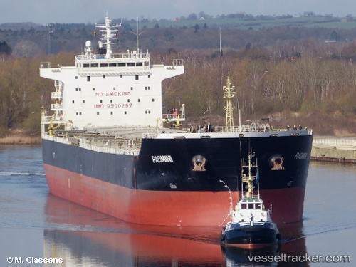
Vessel profile: Agia Ypomoni is a Bulk Carrier with dimensions 225m x 225m.
This page combines live AIS, route history, probable destination signals, nearby traffic, and port activity for practical vessel monitoring.
The current position of vessel Agia Ypomoni is -34.59225 lat / -11.56830 lng. Updated: 2026-06-27 17:36:07 UTCNearest reference points:
- Open sea, approx. 401 nm off the nearest listed port
- Open sea, approx. 403 nm off the nearest listed port
- Open sea (no nearby ports in database)
Currently sailing under the flag of Liberia ![]()
Agia Ypomoni built in 2012 year
Deadweight:
75700 tDetails:
Live Vessel Agia Ypomoni Analytics (details, animations, etc.)
Recent AIS points (UTC):
2026-06-27 14:00:38 UTC · -34.55438, -12.16540 · SOG 8.6 kn · COG 97°2026-06-27 15:57:48 UTC · -34.57351, -11.83905 · SOG 8.2 kn · COG 98°
2026-06-27 17:13:10 UTC · -34.58753, -11.63177 · SOG 8.3 kn · COG 97°
2026-06-27 17:36:07 UTC · -34.59225, -11.56830 · SOG 8.2 kn · COG 98°