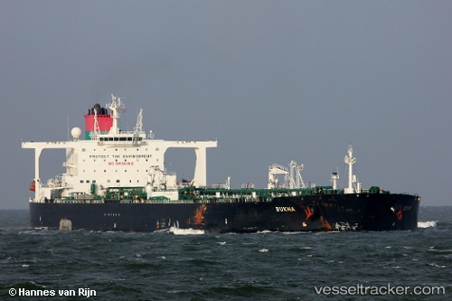
Bukha
Current StatusWhere is the vessel?
Bukha is currently in 85 nm N of Sao Tome and Principe, based on AIS data received about 14h ago.
Latest AIS update:
Current position: 1.71360° N, 6.39102° E (85 nm N of Sao Tome and Principe)
Average speed (last 7 days): Loading…
Average speed (last 30 days): Loading…
Vessel profile: Bukha is a Crude Oil Tanker with dimensions 60m x 333m.
This page combines live AIS, route history, probable destination signals, nearby traffic, and port activity for practical vessel monitoring.
The current position of vessel Bukha is 1.71360 lat / 6.39102 lng. Updated: 2026-05-19 22:46:02 UTCNearest reference points:
- 12 nm SE of Okono
- 12 nm N of Okwori
- 21 nm SW of Bonny
Details:
Live Vessel Bukha Analytics (details, animations, etc.)
Recent AIS points (UTC):
2026-05-19 19:28:00 UTC · 1.15113, 6.09758 · SOG 11.2 kn · COG 31°2026-05-19 19:33:13 UTC · 1.16500, 6.10333 · SOG 11 kn · COG -1°
2026-05-19 21:41:32 UTC · 1.52939, 6.29626 · SOG 11.5 kn · COG 31°
2026-05-19 22:46:02 UTC · 1.71360, 6.39102 · SOG 11.5 kn · COG 29°