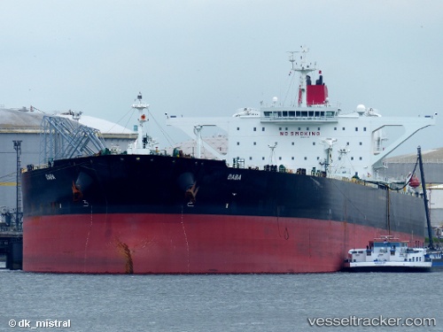
 Daba
Daba
Current Status
Where is the vessel?
Daba is currently in Near Petrozuata, based on AIS data received about 20h ago.
Latest AIS update:
Current position: 10.15764° N, 64.80663° W (Near Petrozuata)
Average speed (last 7 days): Loading…
Average speed (last 30 days): Loading…
Vessel profile: Daba is a Crude Oil Tanker with dimensions 333m x 333m.
This page combines live AIS, route history, probable destination signals, nearby traffic, and port activity for practical vessel monitoring.
The current position of vessel Daba is 10.15764 lat / -64.80663 lng. Updated: 2026-05-20 09:46:54 UTCNearest reference points:
- Near Puerto Sucre
- 15 nm SW of Punta de Piedras
Currently sailing under the flag of Marshall Is ![]()
Daba built in 2012 year
Deadweight:
316373 tDetails:
Live Vessel Daba Analytics (details, animations, etc.)
Recent AIS points (UTC):
2026-05-20 09:46:54 UTC · 10.15764, -64.80663 · SOG 0 kn · COG -1°2026-05-20 09:46:54 UTC · 10.15764, -64.80663 · SOG 0 kn · COG -1°
2026-05-20 09:46:54 UTC · 10.15764, -64.80663 · SOG 0 kn · COG -1°
2026-05-20 09:46:54 UTC · 10.15764, -64.80663 · SOG 0 kn · COG -1°