.
Vessel photo of Star Janni (IMO 9505833) vesseltracker.com

Star Janni

Vessel type: Bulk Carrier | IMO: 9505833 | MMSI: MMSI: 636019138
Call sign: A8SZ5 | Dimensions: 44 m x 292 m
Current Status

Where is the vessel?

Star Janni is currently in 14 nm NE of Furusato, Kagoshima, based on AIS data received about 2h ago.

Latest AIS update:

Current position: 27.50833° N, 128.83667° E (14 nm NE of Furusato, Kagoshima)

Average speed (last 7 days): Loading…

Average speed (last 30 days): Loading…

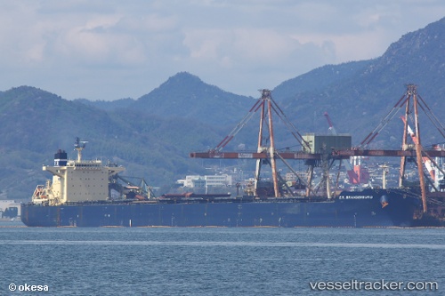
Vessel profile: Star Janni is a Bulk Carrier with dimensions 44m x 292m.

This page combines live AIS, route history, probable destination signals, nearby traffic, and port activity for practical vessel monitoring.

The current position of vessel Star Janni is 27.50833 lat / 128.83667 lng. Updated: 2026-03-28 11:52:26 UTC
Nearest reference points:
  • 18 nm W of Koniya
Details:

Live Vessel Star Janni Analytics (details, animations, etc.)


Recent AIS points (UTC):
2026-03-28 05:33:07 UTC · 28.60257, 128.01611 · SOG 12.5 kn · COG -1°
2026-03-28 07:22:30 UTC · 28.28167, 128.24834 · SOG 12 kn · COG -1°
2026-03-28 09:58:25 UTC · 27.82833, 128.58501 · SOG 12 kn · COG -1°
2026-03-28 11:52:26 UTC · 27.50833, 128.83667 · SOG 12 kn · COG -1°

Track of the vessel in the last 28 days


UTC: --
Start: -- Track timeline (UTC) End: --
Encountered: --


Link to the map:


Find another ship

Star_Janni (636019138) last ports (portcalls and passsages)

Tsugaru-Kaikyo | 2025-07-12 12:33:14
Taicang | 2025-07-08 08:00:27
Nantong | 2025-07-06 03:50:54
Wusong | 2025-07-05 12:02:06
Jingjiang | 2025-07-05 07:22:28
Rizhao | 2025-06-28 11:51:41
Selat Lombok | 2025-06-17 20:40:02
Dampier | 2025-06-13 19:00:17
Qingdao | 2025-03-09 17:22:08
LANSHAN | 2025-03-05 13:15:42
PENGERANG | 2025-02-19 19:04:02
TANAH MERAH | 2025-02-18 06:05:11
BATU AMPAR | 2025-02-18 04:30:48
Singapore | 2025-02-18 03:47:27
PULAU SAMBU | 2025-02-18 03:18:46
Port Louis | 2024-12-04 06:57:08
JURONG ISLAND | 2024-11-21 21:42:55
BUKOM ISLAND | 2024-11-21 21:05:38
PULAU SAMBU | 2024-11-21 20:32:03
TANAH MERAH | 2024-11-19 08:13:33
TANAH MERAH | 2024-11-15 07:49:16
PENGERANG | 2024-11-15 06:04:35
Singapore | 2024-10-12 08:00:50
Richards Bay | 2024-09-22 18:20:36
Richards Bay | 2024-09-15 05:08:56
Sambu | 2024-08-29 08:46:07
Fangcheng | 2024-08-22 10:55:55
Fangcheng | 2024-08-18 09:56:50
Sambu | 2024-08-06 20:58:30
Cape Town | 2024-05-31 03:17:15
Fujairah | 2024-05-09 07:48:20
Sitrah Anchorage | 2024-05-05 17:24:39
Sitrah Anchorage | 2024-05-01 15:40:16
Sept Iles | 2024-03-11 14:22:19
Sept Iles | 2024-03-07 13:33:50
Strait Of Gibraltar | 2024-02-25 19:57:34
Piraeus | 2024-02-11 17:13:38
Strait Of Gibraltar | 2024-01-30 00:23:43
Fujairah | 2023-12-24 01:33:00
Sitrah Anchorage | 2023-12-21 19:10:16
Sitrah Anchorage | 2023-12-17 18:38:22
Sitrah Anchorage | 2023-12-13 17:10:40
Tsugaru-Kaikyo | 2023-09-11 19:24:40
Singapore | 2023-08-17 21:31:23
Ras Gharib | 2023-07-30 01:03:26
Bur Ibrahim | 2023-07-29 15:58:33
Port Said | 2023-07-29 05:37:07
Algeciras | 2023-07-19 08:24:21
Strait Of Gibraltar | 2023-07-19 05:17:38
Taicang | 2023-02-27 10:46:48
Lianyungang | 2023-02-22 05:22:56
Port Headland | 2023-02-04 02:14:42
Selat Lombok | 2023-01-31 02:42:19
Dampier | 2022-12-26 05:48:42
Selat Lombok | 2022-12-19 14:49:39
Wusong | 2022-12-10 05:26:54
Port Headland | 2022-11-17 02:53:59
Port Headland | 2022-10-03 22:48:49
Selat Lombok | 2022-09-29 01:12:38
Singapore | 2022-09-23 11:01:12
Wusong | 2022-09-15 13:16:56
Selat Lombok | 2022-08-20 16:16:40
Port Headland | 2022-08-16 10:42:00
Kao-Hsiung Kang | 2022-08-08 04:57:54
Selat Lombok | 2022-07-12 16:32:57
Samson Point | 2022-07-09 04:17:56
Samson Point | 2022-07-05 04:16:05
Gladstone Harbor | 2022-05-26 16:02:52
Wusong | 2022-04-11 15:42:16
Lianyungang | 2022-04-01 12:33:11
Sambu | 2022-03-20 21:40:12
Richards Bay | 2022-02-15 09:05:24
Wusong | 2022-01-09 09:40:17
Qingdao | 2021-12-26 20:46:10
Sambu | 2021-12-09 02:07:28
Singapore | 2021-12-09 01:20:35
Sabang | 2021-12-06 18:36:41