 Erle
Erle
Current Status
Where is the vessel?
Erle is currently in 20 nm SW of VLYCHADA, based on AIS data received about 14h ago.
Latest AIS update:
Current position: 36.16508° N, 25.08393° E (20 nm SW of VLYCHADA)
Average speed (last 7 days): Loading…
Average speed (last 30 days): Loading…
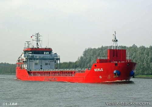
Vessel profile: Erle is a Multi Purpose Carrier with dimensions 90m x 15m.
This page combines live AIS, route history, probable destination signals, nearby traffic, and port activity for practical vessel monitoring.
The current position of vessel Erle is 36.16508 lat / 25.08393 lng. Updated: 2026-05-22 04:14:11 UTCNearest reference points:
- Near Iraklion
- Near PISO LIVADI
- Near Delos
Currently sailing under the flag of Panama ![]()
Erle built in 2011 year
Deadweight:
4690 tDetails:
Live Vessel Erle Analytics (details, animations, etc.)
Recent AIS points (UTC):
2026-05-22 01:12:02 UTC · 36.15231, 25.66855 · SOG 9.3 kn · COG 266°2026-05-22 02:05:13 UTC · 36.15639, 25.49844 · SOG 9.1 kn · COG 267°
2026-05-22 03:31:13 UTC · 36.15779, 25.22110 · SOG 9.3 kn · COG 265°
2026-05-22 04:14:11 UTC · 36.16508, 25.08393 · SOG 9.5 kn · COG 281°