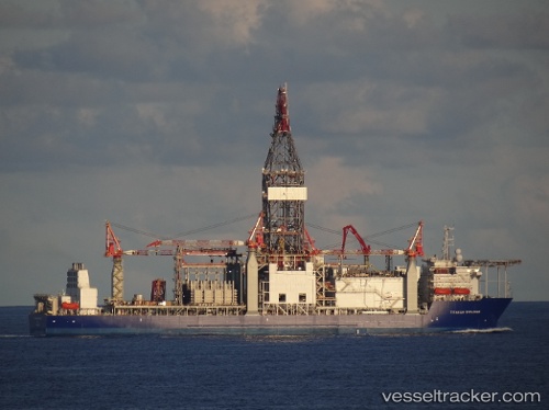
Titanium Explorer
Current StatusWhere is the vessel?
Titanium Explorer is currently in Near Texas City, based on AIS data received about 374d ago.
Latest AIS update:
Current position: 29.36507° N, 94.89027° W (Near Texas City)
Average speed (last 7 days): Loading…
Average speed (last 30 days): Loading…
Vessel profile: Titanium Explorer is a Drilling Ship with dimensions 41m x 237m.
This page combines live AIS, route history, probable destination signals, nearby traffic, and port activity for practical vessel monitoring.
The current position of vessel Titanium Explorer is 29.36507 lat / -94.89027 lng. Updated: 2025-05-11 17:04:09 UTCNearest reference points:
- Near Texas City
- Near Port Bolivar
- Near Clear Lake Shores
Details:
Live Vessel Titanium Explorer Analytics (details, animations, etc.)
Recent AIS points (UTC):
2025-05-11 17:04:09 UTC · 29.36507, -94.89027 · SOG 0 kn · COG 248°