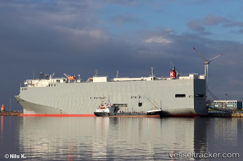
Bangkok Highway
Current StatusWhere is the vessel?
Bangkok Highway is currently in 63 nm E of Ruby, based on AIS data received about 14h ago.
Latest AIS update:
Current position: 10.33728° N, 109.56675° E (63 nm E of Ruby)
Average speed (last 7 days): Loading…
Average speed (last 30 days): Loading…
Vessel profile: Bangkok Highway is a Vehicles Carrier with dimensions 32m x 180m.
This page combines live AIS, route history, probable destination signals, nearby traffic, and port activity for practical vessel monitoring.
The current position of vessel Bangkok Highway is 10.33728 lat / 109.56675 lng. Updated: 2026-05-19 13:57:07 UTCNearest reference points:
- Near Rang Dong
- Near Vinh Cam Ranh
- 156 nm SE of Phan Rang-Tháp Chàm
Details:
Live Vessel Bangkok Highway Analytics (details, animations, etc.)
Recent AIS points (UTC):
2026-05-19 10:50:19 UTC · 9.58988, 109.00247 · SOG 18.4 kn · COG -1°2026-05-19 11:35:44 UTC · 9.74488, 109.17845 · SOG 18.3 kn · COG -1°
2026-05-19 13:12:31 UTC · 10.13887, 109.46605 · SOG 17.8 kn · COG 23°
2026-05-19 13:57:07 UTC · 10.33728, 109.56675 · SOG 17.3 kn · COG -1°