 Mt Sambu
Current Status
Where is the vessel?
Mt Sambu is currently in Near BATU AMPAR, based on AIS data received about 14h ago.
Latest AIS update:
Current position: 1.17854° N, 103.94863° E (Near BATU AMPAR)
Average speed (last 7 days): Loading…
Average speed (last 30 days): Loading…
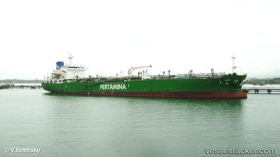
Vessel profile: Mt Sambu is a Oil Products Tanker with dimensions 180m x 30m.
This page combines live AIS, route history, probable destination signals, nearby traffic, and port activity for practical vessel monitoring.
The current position of vessel Mt Sambu is 1.17854 lat / 103.94863 lng. Updated: 2026-05-20 17:38:22 UTCNearest reference points:
- Near Sambu
- Near BATU AMPAR
- Near Sekupang
Currently sailing under the flag of Indonesia ![]()
Mt Sambu built in 2011 year
Deadweight:
29756 tDetails:
Live Vessel Mt Sambu Analytics (details, animations, etc.)
Recent AIS points (UTC):
2026-05-20 14:26:20 UTC · 1.17853, 103.94711 · SOG 0 kn · COG 66°2026-05-20 15:57:23 UTC · 1.17833, 103.94667 · SOG 0 kn · COG -1°
2026-05-20 16:32:17 UTC · 1.17867, 103.94761 · SOG 0 kn · COG 18°
2026-05-20 17:38:22 UTC · 1.17854, 103.94863 · SOG 0.2 kn · COG 354°