 vesseltracker.com
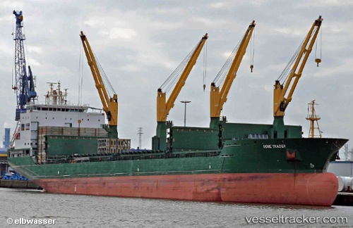
 CHIPOL CHANGAN
Current Status
Where is the vessel?
CHIPOL CHANGAN is currently in Near Taicang, based on AIS data received about 1h ago.
Latest AIS update:
Current position: 31.62924° N, 121.23937° E (Near Taicang)
Average speed (last 7 days): Loading…
Average speed (last 30 days): Loading…
Vessel profile: CHIPOL CHANGAN is a General Cargo Ship with dimensions 180m x 28m.
This page combines live AIS, route history, probable destination signals, nearby traffic, and port activity for practical vessel monitoring.
The current position of vessel CHIPOL CHANGAN is 31.62924 lat / 121.23937 lng. Updated: 2026-05-16 12:06:03 UTCNearest reference points:
- Near Taicang
- Near Jiading
- Near Chongming
Currently sailing under the flag of Liberia ![]()
CHIPOL CHANGAN built in 2010 year
Deadweight:
33174 tDetails:
Live Vessel CHIPOL CHANGAN Analytics (details, animations, etc.)
Recent AIS points (UTC):
2026-05-16 07:42:03 UTC · 31.62926, 121.23938 · SOG 0 kn · COG 316°2026-05-16 09:27:05 UTC · 31.62926, 121.23938 · SOG 0 kn · COG 316°
2026-05-16 10:42:05 UTC · 31.62927, 121.23937 · SOG 0 kn · COG 315°
2026-05-16 12:06:03 UTC · 31.62924, 121.23937 · SOG 0 kn · COG 316°