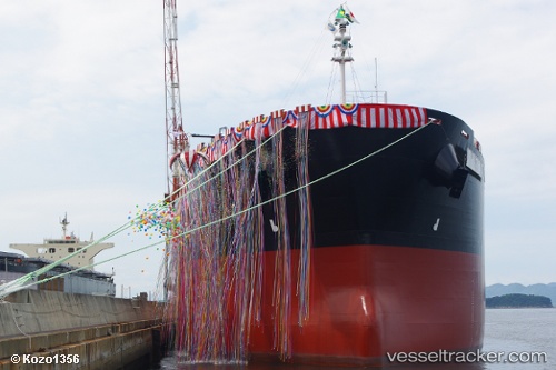
Forte De Sao Jose
Current StatusWhere is the vessel?
Forte De Sao Jose is currently in Near Alumar, based on AIS data received about 14h ago.
Latest AIS update:
Current position: 2.67786° S, 44.36040° W (Near Alumar)
Average speed (last 7 days): Loading…
Average speed (last 30 days): Loading…
Vessel profile: Forte De Sao Jose is a Bulk Carrier with dimensions 32m x 225m.
This page combines live AIS, route history, probable destination signals, nearby traffic, and port activity for practical vessel monitoring.
The current position of vessel Forte De Sao Jose is -2.67786 lat / -44.36040 lng. Updated: 2026-05-22 11:06:38 UTCNearest reference points:
- 53 nm N of Beija-Flor
Details:
Live Vessel Forte De Sao Jose Analytics (details, animations, etc.)
Recent AIS points (UTC):
2026-05-22 07:48:35 UTC · -2.67784, -44.36048 · SOG 0 kn · COG 94°2026-05-22 08:03:36 UTC · -2.67784, -44.36039 · SOG 0 kn · COG 94°
2026-05-22 09:54:34 UTC · -2.67784, -44.36038 · SOG 0 kn · COG 94°
2026-05-22 11:06:38 UTC · -2.67786, -44.36040 · SOG 0 kn · COG 94°