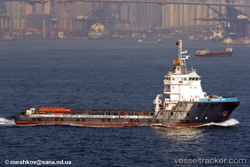
Brasher Tide
Current StatusWhere is the vessel?
Brasher Tide is currently in 14 nm S of Abu Musa, based on AIS data received about 18h ago.
Latest AIS update:
Current position: 25.63487° N, 55.08801° E (14 nm S of Abu Musa)
Average speed (last 7 days): Loading…
Average speed (last 30 days): Loading…
Vessel profile: Brasher Tide is a Offshore Tug Supply Ship with dimensions 17m x 68m.
This page combines live AIS, route history, probable destination signals, nearby traffic, and port activity for practical vessel monitoring.
The current position of vessel Brasher Tide is 25.63487 lat / 55.08801 lng. Updated: 2026-05-20 23:52:05 UTCNearest reference points:
- 17 nm NW of Free Port
- Near Sharjah
- Near Free Port
Details:
Live Vessel Brasher Tide Analytics (details, animations, etc.)
Recent AIS points (UTC):
2026-05-20 23:52:05 UTC · 25.63487, 55.08801 · SOG 0.2 kn · COG 290°2026-05-20 23:52:05 UTC · 25.63487, 55.08801 · SOG 0.2 kn · COG 290°
2026-05-20 23:52:05 UTC · 25.63487, 55.08801 · SOG 0.2 kn · COG 290°
2026-05-20 23:52:05 UTC · 25.63487, 55.08801 · SOG 0.2 kn · COG 290°