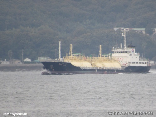
 Ryoan Maru
Current Status
Where is the vessel?
Ryoan Maru is currently in 22 nm S of TOYOHASHI, based on AIS data received about 15h ago.
Latest AIS update:
Current position: 34.36201° N, 137.35222° E (22 nm S of TOYOHASHI)
Average speed (last 7 days): Loading…
Average speed (last 30 days): Loading…
Vessel profile: Ryoan Maru is a Lpg Tanker with dimensions 72m x 12m.
This page combines live AIS, route history, probable destination signals, nearby traffic, and port activity for practical vessel monitoring.
The current position of vessel Ryoan Maru is 34.36201 lat / 137.35222 lng. Updated: 2026-05-20 10:31:52 UTCNearest reference points:
- 17 nm S of TOYOHASHI
- 12 nm E of TOBA
- Near TOYOHASHI
Currently sailing under the flag of Japan ![]()
Details:
Live Vessel Ryoan Maru Analytics (details, animations, etc.)
Recent AIS points (UTC):
2026-05-20 07:51:58 UTC · 34.52088, 138.02097 · SOG 12.9 kn · COG 258°2026-05-20 09:50:28 UTC · 34.43240, 137.50710 · SOG 13.1 kn · COG 244°
2026-05-20 09:50:28 UTC · 34.43240, 137.50710 · SOG 13.1 kn · COG 244°
2026-05-20 10:31:52 UTC · 34.36201, 137.35222 · SOG 12.8 kn · COG 242°