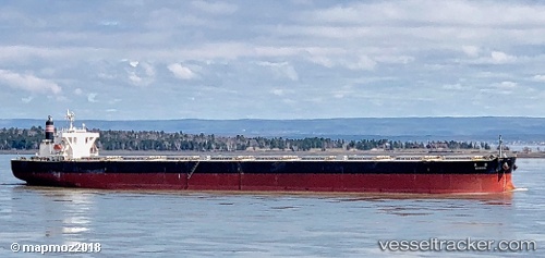
Shirara
Current StatusWhere is the vessel?
Shirara is currently in 372 nm SW of Georgetown, based on AIS data received about 15h ago.
Latest AIS update:
Current position: 12.01038° S, 19.14532° W (372 nm SW of Georgetown)
Average speed (last 7 days): Loading…
Average speed (last 30 days): Loading…
Vessel profile: Shirara is a Bulk Carrier with dimensions 45m x 289m.
This page combines live AIS, route history, probable destination signals, nearby traffic, and port activity for practical vessel monitoring.
The current position of vessel Shirara is -12.01038 lat / -19.14532 lng. Updated: 2026-05-21 04:07:38 UTCNearest reference points:
- Open sea, approx. 401 nm off the nearest listed port
- Open sea, approx. 403 nm off the nearest listed port
- Open sea, approx. 405 nm off the nearest listed port
Details:
Live Vessel Shirara Analytics (details, animations, etc.)
Recent AIS points (UTC):
2026-05-21 01:11:09 UTC · -11.72943, -19.58617 · SOG 10.4 kn · COG 122°2026-05-21 01:57:18 UTC · -11.80388, -19.47157 · SOG 10.5 kn · COG 121°
2026-05-21 03:23:58 UTC · -11.93972, -19.25445 · SOG 10.5 kn · COG 120°
2026-05-21 04:07:38 UTC · -12.01038, -19.14532 · SOG 10.4 kn · COG 120°