 Horai Bridge
Current Status
Where is the vessel?
Horai Bridge is currently in 30 nm S of Pinghai, based on AIS data received about 14h ago.
Latest AIS update:
Current position: 22.13300° N, 115.05763° E (30 nm S of Pinghai)
Average speed (last 7 days): Loading…
Average speed (last 30 days): Loading…
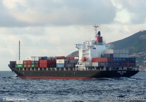
Vessel profile: Horai Bridge is a Container Ship with dimensions 172m x 28m.
This page combines live AIS, route history, probable destination signals, nearby traffic, and port activity for practical vessel monitoring.
The current position of vessel Horai Bridge is 22.13300 lat / 115.05763 lng. Updated: 2026-06-06 01:56:44 UTCNearest reference points:
- 14 nm S of Pinghai
- Near Pinghai
- 12 nm S of Pinghai
Currently sailing under the flag of Panama ![]()
Horai Bridge built in 2009 year
Deadweight:
21922 tDetails:
Live Vessel Horai Bridge Analytics (details, animations, etc.)
Recent AIS points (UTC):
2026-06-05 21:48:15 UTC · 22.18770, 116.35778 · SOG 18 kn · COG 263°2026-06-05 23:27:26 UTC · 22.14920, 115.85098 · SOG 17.4 kn · COG 265°
2026-06-06 01:54:14 UTC · 22.13312, 115.07097 · SOG 17.9 kn · COG 271°
2026-06-06 01:56:44 UTC · 22.13300, 115.05763 · SOG 17.5 kn · COG 270°