 Elpis
Elpis
Current Status
Where is the vessel?
Elpis is currently in Near ITACOATIARA, based on AIS data received about 14h ago.
Latest AIS update:
Current position: 3.16786° S, 58.43442° W (Near ITACOATIARA)
Average speed (last 7 days): Loading…
Average speed (last 30 days): Loading…
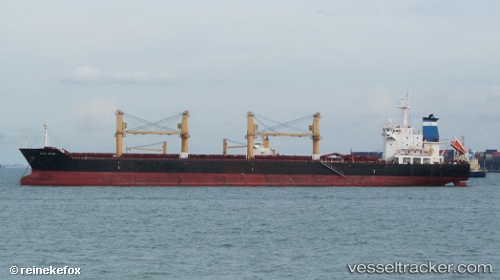
Vessel profile: Elpis is a Bulk Carrier with dimensions 181m x 30m.
This page combines live AIS, route history, probable destination signals, nearby traffic, and port activity for practical vessel monitoring.
The current position of vessel Elpis is -3.16786 lat / -58.43442 lng. Updated: 2026-07-03 00:24:08 UTCNearest reference points:
- Near ITACOATIARA
- Near Manaus
Currently sailing under the flag of Liberia ![]()
Elpis built in 2009 year
Deadweight:
34000 tDetails:
Live Vessel Elpis Analytics (details, animations, etc.)
Recent AIS points (UTC):
2026-07-02 19:57:08 UTC · -3.16788, -58.43440 · SOG 0.1 kn · COG 297°2026-07-02 21:39:08 UTC · -3.16785, -58.43444 · SOG 0 kn · COG 299°
2026-07-02 22:24:08 UTC · -3.16794, -58.43446 · SOG 0 kn · COG 299°
2026-07-03 00:24:08 UTC · -3.16786, -58.43442 · SOG 0 kn · COG 296°