 vesseltracker.com
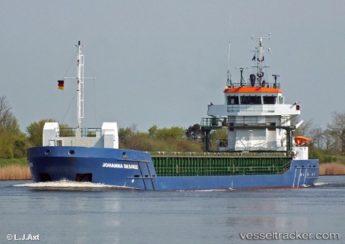
 Rosi
Rosi
Current Status
Where is the vessel?
Rosi is currently in Near Bettystown, based on AIS data received about 1h ago.
Latest AIS update:
Current position: 53.72952° N, 6.18082° W (Near Bettystown)
Average speed (last 7 days): Loading…
Average speed (last 30 days): Loading…
Vessel profile: Rosi is a General Cargo Ship with dimensions 89m x 13m.
This page combines live AIS, route history, probable destination signals, nearby traffic, and port activity for practical vessel monitoring.
The current position of vessel Rosi is 53.72952 lat / -6.18082 lng. Updated: 2026-03-25 08:05:46 UTCNearest reference points:
- Near Skerries
- Near GREENORE
- Near Greencastle
Currently sailing under the flag of Portugal ![]()
Rosi built in 2010 year
Deadweight:
3850 tDetails:
Live Vessel Rosi Analytics (details, animations, etc.)
Recent AIS points (UTC):
2026-03-25 02:26:44 UTC · 53.72926, -6.18105 · SOG 0.1 kn · COG 295°2026-03-25 03:50:46 UTC · 53.72932, -6.18104 · SOG 0.1 kn · COG 293°
2026-03-25 05:20:46 UTC · 53.72944, -6.18087 · SOG 0.1 kn · COG 290°
2026-03-25 08:05:46 UTC · 53.72952, -6.18082 · SOG 0.1 kn · COG 292°