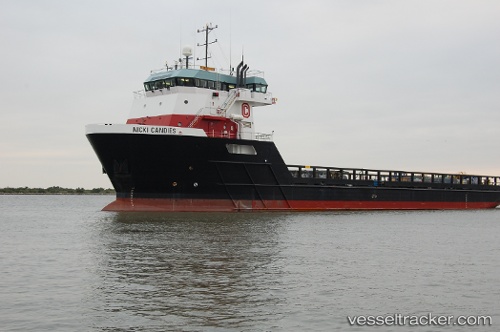
 Nicki Candies
Current Status
Where is the vessel?
Nicki Candies is currently in 132 nm E of South Padre Island, based on AIS data received about 14h ago.
Latest AIS update:
Current position: 26.23167° N, 94.70500° W (132 nm E of South Padre Island)
Average speed (last 7 days): Loading…
Average speed (last 30 days): Loading…
Vessel profile: Nicki Candies is a Offshore Tug Supply Ship with dimensions 87m x 18m.
This page combines live AIS, route history, probable destination signals, nearby traffic, and port activity for practical vessel monitoring.
The current position of vessel Nicki Candies is 26.23167 lat / -94.70500 lng. Updated: 2026-05-20 01:35:32 UTCNearest reference points:
- 63 nm SE of Quintana
- 56 nm SE of Quintana
- 49 nm SE of Sheppard
Currently sailing under the flag of USA ![]()
Nicki Candies built in 2009 year
Deadweight:
5246 tDetails:
Live Vessel Nicki Candies Analytics (details, animations, etc.)
Recent AIS points (UTC):
2026-05-19 22:03:56 UTC · 26.23132, -94.72854 · SOG 0.2 kn · COG -1°2026-05-20 00:13:44 UTC · 26.23130, -94.72849 · SOG 0.1 kn · COG -1°
2026-05-20 01:14:31 UTC · 26.23167, -94.72667 · SOG 1 kn · COG -1°
2026-05-20 01:35:32 UTC · 26.23167, -94.70500 · SOG 6 kn · COG -1°