 vesseltracker.com
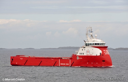
 Rem Hrist
Current Status
Where is the vessel?
Rem Hrist is currently in Near Flem, based on AIS data received less than 1h ago.
Latest AIS update:
Current position: 62.80687° N, 6.06371° E (Near Flem)
Average speed (last 7 days): Loading…
Average speed (last 30 days): Loading…
Vessel profile: Rem Hrist is a Offshore Tug Supply Ship with dimensions 88m x 19m.
This page combines live AIS, route history, probable destination signals, nearby traffic, and port activity for practical vessel monitoring.
The current position of vessel Rem Hrist is 62.80687 lat / 6.06371 lng. Updated: 2026-04-25 01:52:11 UTCNearest reference points:
- Near Gjøsundet
- Near Brattvåg
- Near Alesund
Currently sailing under the flag of Norway ![]()
Rem Hrist built in 2011 year
Deadweight:
4258 tDetails:
Live Vessel Rem Hrist Analytics (details, animations, etc.)
Recent AIS points (UTC):
2026-04-24 22:15:11 UTC · 63.15674, 7.16763 · SOG 5.3 kn · COG 299°2026-04-24 23:27:01 UTC · 63.04585, 6.80571 · SOG 10.5 kn · COG 238°
2026-04-25 01:38:20 UTC · 62.83285, 6.13609 · SOG 10.2 kn · COG 242°
2026-04-25 01:52:11 UTC · 62.80687, 6.06371 · SOG 11.2 kn · COG 226°