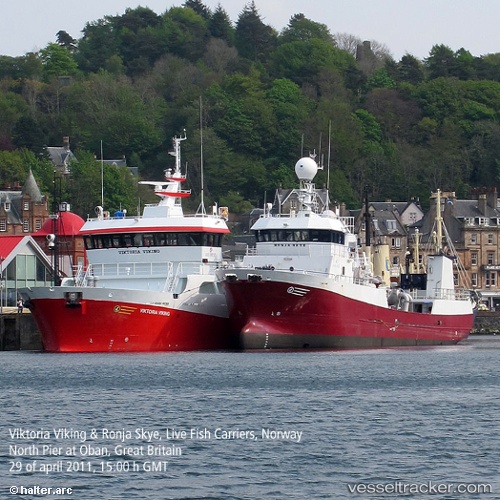
Viktoria Viking
Current StatusWhere is the vessel?
Viktoria Viking is currently in 22 nm E of Ramea, based on AIS data received about 15h ago.
Latest AIS update:
Current position: 47.49746° N, 56.86433° W (22 nm E of Ramea)
Average speed (last 7 days): Loading…
Average speed (last 30 days): Loading…
Vessel profile: Viktoria Viking is a Fish Carrier with dimensions 12m x 57m.
This page combines live AIS, route history, probable destination signals, nearby traffic, and port activity for practical vessel monitoring.
The current position of vessel Viktoria Viking is 47.49746 lat / -56.86433 lng. Updated: 2026-06-03 19:18:26 UTCNearest reference points:
- Near MIQUELON
- Near SAINT PIERRE
- Near Fortune
Details:
Live Vessel Viktoria Viking Analytics (details, animations, etc.)
Recent AIS points (UTC):
2026-06-03 15:44:28 UTC · 47.53833, -57.68500 · SOG 9 kn · COG -1°2026-06-03 16:20:26 UTC · 47.53833, -57.54833 · SOG 10 kn · COG -1°
2026-06-03 18:35:24 UTC · 47.51167, -57.02167 · SOG 10 kn · COG -1°
2026-06-03 19:18:26 UTC · 47.49746, -56.86433 · SOG 8.5 kn · COG 94°