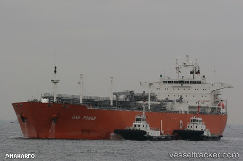
Gas Power
Current StatusWhere is the vessel?
Gas Power is currently in 109 nm W of Perula, based on AIS data received about 16h ago.
Latest AIS update:
Current position: 18.92998° N, 106.90255° W (109 nm W of Perula)
Average speed (last 7 days): Loading…
Average speed (last 30 days): Loading…
Vessel profile: Gas Power is a Lpg Tanker with dimensions 37m x 230m.
This page combines live AIS, route history, probable destination signals, nearby traffic, and port activity for practical vessel monitoring.
The current position of vessel Gas Power is 18.92998 lat / -106.90255 lng. Updated: 2026-05-20 11:15:58 UTCNearest reference points:
- 35 nm S of Nayarit
- Near NUEVO VALLARTA
Details:
Live Vessel Gas Power Analytics (details, animations, etc.)
Recent AIS points (UTC):
2026-05-20 08:09:12 UTC · 18.59650, -106.21463 · SOG 14 kn · COG 298°2026-05-20 09:53:28 UTC · 18.78091, -106.59732 · SOG 14 kn · COG 299°
2026-05-20 10:12:23 UTC · 18.81521, -106.66654 · SOG 14 kn · COG 299°
2026-05-20 11:15:58 UTC · 18.92998, -106.90255 · SOG 14.1 kn · COG 299°