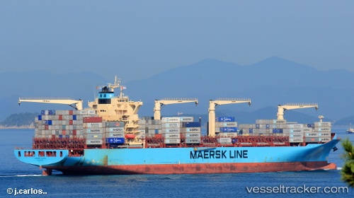
 Maersk Congo
Current Status
Where is the vessel?
Maersk Congo is currently in Near Dambadure, based on AIS data received about 15h ago.
Latest AIS update:
Current position: 7.08088° N, 79.73708° E (Near Dambadure)
Average speed (last 7 days): Loading…
Average speed (last 30 days): Loading…
Vessel profile: Maersk Congo is a Container Ship with dimensions 249m x 37m.
This page combines live AIS, route history, probable destination signals, nearby traffic, and port activity for practical vessel monitoring.
The current position of vessel Maersk Congo is 7.08088 lat / 79.73708 lng. Updated: 2026-05-20 17:59:08 UTCNearest reference points:
- 19 nm SW of Bataduwa
- 67 nm SW of Moratuwa
- 38 nm SW of Galle
Currently sailing under the flag of Singapore ![]()
Maersk Congo built in 2011 year
Deadweight:
61614 tDetails:
Live Vessel Maersk Congo Analytics (details, animations, etc.)
Recent AIS points (UTC):
2026-05-20 13:37:48 UTC · 7.05253, 79.32609 · SOG 6.7 kn · COG 149°2026-05-20 15:34:07 UTC · 7.05307, 79.49728 · SOG 7 kn · COG 93°
2026-05-20 16:47:07 UTC · 7.07333, 79.61240 · SOG 7 kn · COG 89°
2026-05-20 17:59:08 UTC · 7.08088, 79.73708 · SOG 4.2 kn · COG 263°