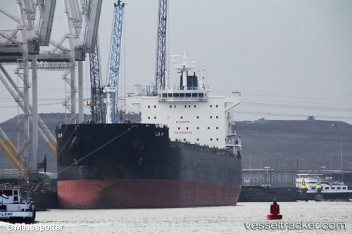
Lia M
Current StatusWhere is the vessel?
Lia M is currently in 218 nm SE of Richards Bay, based on AIS data received about 15h ago.
Latest AIS update:
Current position: 30.56435° S, 35.81414° E (218 nm SE of Richards Bay)
Average speed (last 7 days): Loading…
Average speed (last 30 days): Loading…
Vessel profile: Lia M is a Bulk Carrier with dimensions 32m x 235m.
This page combines live AIS, route history, probable destination signals, nearby traffic, and port activity for practical vessel monitoring.
The current position of vessel Lia M is -30.56435 lat / 35.81414 lng. Updated: 2026-05-19 22:32:09 UTCNearest reference points:
- 163 nm SE of Richards Bay
- 181 nm SE of Hibberdene
- Open sea, approx. 400 nm off the nearest listed port
Details:
Live Vessel Lia M Analytics (details, animations, etc.)
Recent AIS points (UTC):
2026-05-19 19:26:51 UTC · -30.75391, 35.22489 · SOG 10.8 kn · COG 77°2026-05-19 20:09:47 UTC · -30.71578, 35.36418 · SOG 10.4 kn · COG 75°
2026-05-19 21:54:48 UTC · -30.62423, 35.70384 · SOG 10.8 kn · COG 60°
2026-05-19 22:32:09 UTC · -30.56435, 35.81414 · SOG 10.7 kn · COG 61°