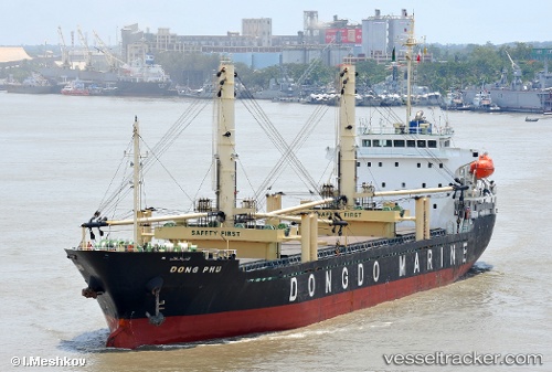
Dong Phu
Current StatusWhere is the vessel?
Dong Phu is currently in Near Majunga, based on AIS data received about 15h ago.
Latest AIS update:
Current position: 15.72012° S, 46.28890° E (Near Majunga)
Average speed (last 7 days): Loading…
Average speed (last 30 days): Loading…
Vessel profile: Dong Phu is a General Cargo Ship with dimensions 21m x 137m.
This page combines live AIS, route history, probable destination signals, nearby traffic, and port activity for practical vessel monitoring.
The current position of vessel Dong Phu is -15.72012 lat / 46.28890 lng. Updated: 2026-05-21 05:57:06 UTCNearest reference points:
- 14 nm SW of Nosy-Be
Details:
Live Vessel Dong Phu Analytics (details, animations, etc.)
Recent AIS points (UTC):
2026-05-21 01:43:10 UTC · -15.53232, 46.30775 · SOG 6.3 kn · COG 178°2026-05-21 03:51:31 UTC · -15.72145, 46.28363 · SOG 2.9 kn · COG 96°
2026-05-21 04:07:18 UTC · -15.72018, 46.29055 · SOG 1.7 kn · COG 298°
2026-05-21 05:57:06 UTC · -15.72012, 46.28890 · SOG 0 kn · COG 182°