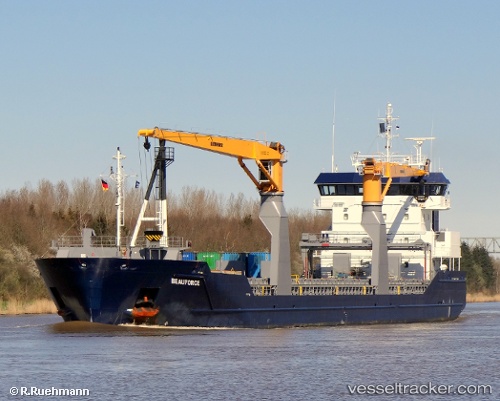
 Beauforce
Current Status
Where is the vessel?
Beauforce is currently in 19 nm NW of Goto, based on AIS data received about 14h ago.
Latest AIS update:
Current position: 12.48346° N, 68.54942° W (19 nm NW of Goto)
Average speed (last 7 days): Loading…
Average speed (last 30 days): Loading…
Vessel profile: Beauforce is a Multi Purpose Carrier with dimensions 118m x 118m.
This page combines live AIS, route history, probable destination signals, nearby traffic, and port activity for practical vessel monitoring.
The current position of vessel Beauforce is 12.48346 lat / -68.54942 lng. Updated: 2026-05-21 04:10:30 UTCNearest reference points:
- Near Bullenbaai
- 24 nm NW of Palm Beach
- Near Las Piedras
Currently sailing under the flag of Netherlands ![]()
Beauforce built in 2010 year
Deadweight:
8284 tDetails:
Live Vessel Beauforce Analytics (details, animations, etc.)
Recent AIS points (UTC):
2026-05-20 23:30:57 UTC · 12.36577, -67.75734 · SOG 10.4 kn · COG 281°2026-05-21 02:00:26 UTC · 12.43800, -68.18826 · SOG 10.4 kn · COG 281°
2026-05-21 02:01:08 UTC · 12.43846, -68.19019 · SOG 10.4 kn · COG 280°
2026-05-21 04:10:30 UTC · 12.48346, -68.54942 · SOG 9.8 kn · COG 281°