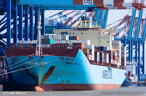
 MAERSK LETICIA
Current Status
Where is the vessel?
MAERSK LETICIA is currently in 16 nm E of Imbituba, based on AIS data received about 14h ago.
Latest AIS update:
Current position: 28.20549° S, 48.33033° W (16 nm E of Imbituba)
Average speed (last 7 days): Loading…
Average speed (last 30 days): Loading…
Vessel profile: MAERSK LETICIA is a Container Ship with dimensions m x m.
This page combines live AIS, route history, probable destination signals, nearby traffic, and port activity for practical vessel monitoring.
The current position of vessel MAERSK LETICIA is -28.20549 lat / -48.33033 lng. Updated: 2026-05-19 23:53:06 UTCNearest reference points:
- 14 nm SE of Imbituba
- 15 nm SE of Imbituba
- 10 nm NE of CAMBORIU
Currently sailing under the flag of Denmark ![]()
Details:
Live Vessel MAERSK LETICIA Analytics (details, animations, etc.)
Recent AIS points (UTC):
2026-05-19 19:48:00 UTC · -26.91129, -48.12952 · SOG 19.5 kn · COG 190°2026-05-19 21:30:54 UTC · -27.46346, -48.15087 · SOG 19.2 kn · COG 192°
2026-05-19 22:59:11 UTC · -27.92498, -48.25702 · SOG 19.2 kn · COG 192°
2026-05-19 23:53:06 UTC · -28.20549, -48.33033 · SOG 19.3 kn · COG 197°