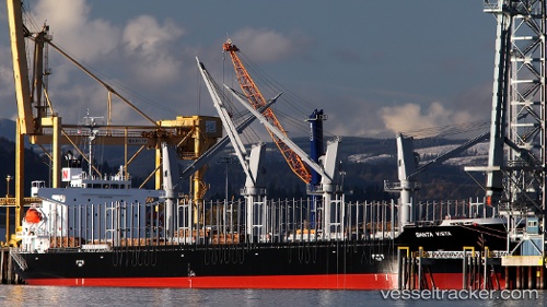
Santa Vista
Current StatusWhere is the vessel?
Santa Vista is currently in 160 nm E of Mitchem, based on AIS data received about 15h ago.
Latest AIS update:
Current position: 50.61365° N, 170.76263° W (160 nm E of Mitchem)
Average speed (last 7 days): Loading…
Average speed (last 30 days): Loading…
Vessel profile: Santa Vista is a General Cargo Ship with dimensions 31m x 185m.
This page combines live AIS, route history, probable destination signals, nearby traffic, and port activity for practical vessel monitoring.
The current position of vessel Santa Vista is 50.61365 lat / -170.76263 lng. Updated: 2026-06-25 12:02:47 UTCDetails:
Live Vessel Santa Vista Analytics (details, animations, etc.)
Recent AIS points (UTC):
2026-06-25 08:12:08 UTC · 50.48110, -171.93860 · SOG 12.6 kn · COG 82°2026-06-25 09:44:36 UTC · 50.53813, -171.45961 · SOG 11.8 kn · COG 83°
2026-06-25 10:35:46 UTC · 50.56445, -171.20250 · SOG 12 kn · COG 81°
2026-06-25 12:02:47 UTC · 50.61365, -170.76263 · SOG 12.3 kn · COG 85°