 vesseltracker.com
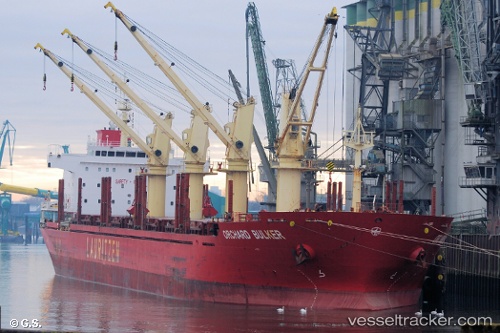
 CLIPPER ALEXANDRIA
Current Status
Where is the vessel?
CLIPPER ALEXANDRIA is currently in 217 nm NE of Tan Cang Qui Nhon, based on AIS data received less than 1h ago.
Latest AIS update:
Current position: 15.39978° N, 113.17304° E (217 nm NE of Tan Cang Qui Nhon)
Average speed (last 7 days): Loading…
Average speed (last 30 days): Loading…
Vessel profile: CLIPPER ALEXANDRIA is a Bulk Carrier with dimensions 180m x 28m.
This page combines live AIS, route history, probable destination signals, nearby traffic, and port activity for practical vessel monitoring.
The current position of vessel CLIPPER ALEXANDRIA is 15.39978 lat / 113.17304 lng. Updated: 2026-05-17 10:02:04 UTCNearest reference points:
- 215 nm NE of Tan Cang Qui Nhon
- 222 nm E of Tan Cang Qui Nhon
- 232 nm E of Tan Cang Qui Nhon
Currently sailing under the flag of Marshall Islands ![]()
CLIPPER ALEXANDRIA built in 2010 year
Deadweight:
32535 tDetails:
Live Vessel CLIPPER ALEXANDRIA Analytics (details, animations, etc.)
Recent AIS points (UTC):
2026-05-17 07:35:48 UTC · 15.67667, 113.38833 · SOG 8 kn · COG -1°2026-05-17 08:17:51 UTC · 15.59667, 113.32833 · SOG 8 kn · COG -1°
2026-05-17 09:33:52 UTC · 15.45469, 113.21495 · SOG 8.6 kn · COG 216°
2026-05-17 10:02:04 UTC · 15.39978, 113.17304 · SOG 8.6 kn · COG 214°