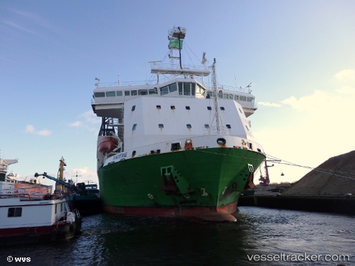
 Flintstone
Current Status
Where is the vessel?
Flintstone is currently in Near Kristiansand, based on AIS data received about 14h ago.
Latest AIS update:
Current position: 58.13127° N, 8.02497° E (Near Kristiansand)
Average speed (last 7 days): Loading…
Average speed (last 30 days): Loading…
Vessel profile: Flintstone is a Pipe Burying Vessel with dimensions 155m x 32m.
This page combines live AIS, route history, probable destination signals, nearby traffic, and port activity for practical vessel monitoring.
The current position of vessel Flintstone is 58.13127 lat / 8.02497 lng. Updated: 2026-07-14 02:08:20 UTCNearest reference points:
- Near Kristiansand
- 27 nm N of HANSTHOLM
- Near HANSTHOLM
Currently sailing under the flag of Netherlands ![]()
Flintstone built in 2011 year
Deadweight:
19558 tDetails:
Live Vessel Flintstone Analytics (details, animations, etc.)
Recent AIS points (UTC):
2026-07-13 22:32:40 UTC · 58.13126, 8.02497 · SOG 0 kn · COG 350°2026-07-13 23:44:59 UTC · 58.13127, 8.02497 · SOG 0 kn · COG 350°
2026-07-14 01:31:40 UTC · 58.13127, 8.02496 · SOG 0 kn · COG 350°
2026-07-14 02:08:20 UTC · 58.13127, 8.02497 · SOG 0 kn · COG 350°