 vesseltracker.com
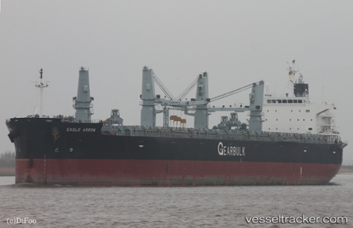
 Eagle Arrow
Current Status
Where is the vessel?
Eagle Arrow is currently in 12 nm SW of Qisha Pt, based on AIS data received about 14h ago.
Latest AIS update:
Current position: 21.39980° N, 108.37923° E (12 nm SW of Qisha Pt)
Average speed (last 7 days): Loading…
Average speed (last 30 days): Loading…
Vessel profile: Eagle Arrow is a Bulk Carrier with dimensions 199m x 31m.
This page combines live AIS, route history, probable destination signals, nearby traffic, and port activity for practical vessel monitoring.
The current position of vessel Eagle Arrow is 21.39980 lat / 108.37923 lng. Updated: 2026-05-18 07:53:18 UTCNearest reference points:
- Near Fangcheng
- Near Qisha Pt
- 22 nm SE of Dongxing
Currently sailing under the flag of Panama ![]()
Eagle Arrow built in 2011 year
Deadweight:
61860 tDetails:
Live Vessel Eagle Arrow Analytics (details, animations, etc.)
Recent AIS points (UTC):
2026-05-18 04:17:20 UTC · 21.39977, 108.37883 · SOG 0 kn · COG 145°2026-05-18 06:17:18 UTC · 21.39985, 108.37905 · SOG 0 kn · COG 151°
2026-05-18 07:08:17 UTC · 21.39982, 108.37908 · SOG 0 kn · COG 147°
2026-05-18 07:53:18 UTC · 21.39980, 108.37923 · SOG 0.2 kn · COG 157°