 vesseltracker.com
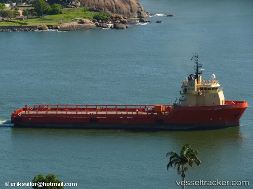
Santos Service
Current StatusWhere is the vessel?
Santos Service is currently in 40 nm NE of Cidade de Angra dos Reis FPSO, based on AIS data received about 14h ago.
Latest AIS update:
Current position: 24.95500° S, 42.47333° W (40 nm NE of Cidade de Angra dos Reis FPSO)
Average speed (last 7 days): Loading…
Average speed (last 30 days): Loading…
Vessel profile: Santos Service is a Offshore Tug Supply Ship with dimensions 18m x 84m.
This page combines live AIS, route history, probable destination signals, nearby traffic, and port activity for practical vessel monitoring.
The current position of vessel Santos Service is -24.95500 lat / -42.47333 lng. Updated: 2026-05-18 13:21:27 UTCNearest reference points:
- 69 nm NE of Cidade de Angra dos Reis FPSO
- 34 nm S of Cidade de Angra dos Reis FPSO
- 49 nm S of SEPETIBA
Details:
Live Vessel Santos Service Analytics (details, animations, etc.)
Recent AIS points (UTC):
2026-05-18 11:00:28 UTC · -24.95500, -42.47333 · SOG 0 kn · COG -1°2026-05-18 12:18:29 UTC · -24.95500, -42.47333 · SOG 0 kn · COG -1°
2026-05-18 13:03:26 UTC · -24.95500, -42.47333 · SOG 0 kn · COG -1°
2026-05-18 13:21:27 UTC · -24.95500, -42.47333 · SOG 0 kn · COG -1°